
A copper-molybdenum porphyry system in the Idaho Porphyry Belt.
About 1,033 acres across 50 unpatented lode claims, 21 km north-northwest of Salmon and beside U.S. Highway 93. Historic drilling returned 100.13 m of 0.365% copper from 74.83 m in hole BC-1, including 51.05 m of 0.486% copper. The Company holds an 80% interest, acquired from BG Copper Corp. in 2026.
FlagshipAcquisition closed
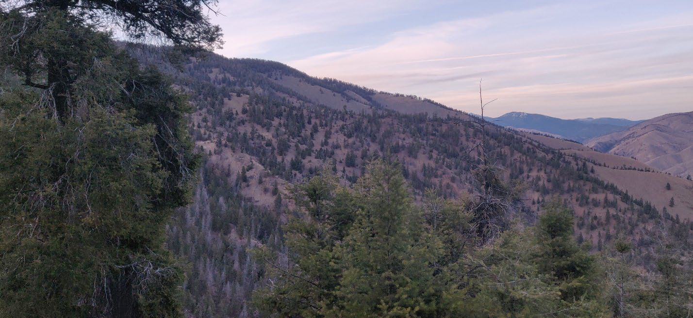 Bobcat Project · site photograph
Where five geological provinces meet.
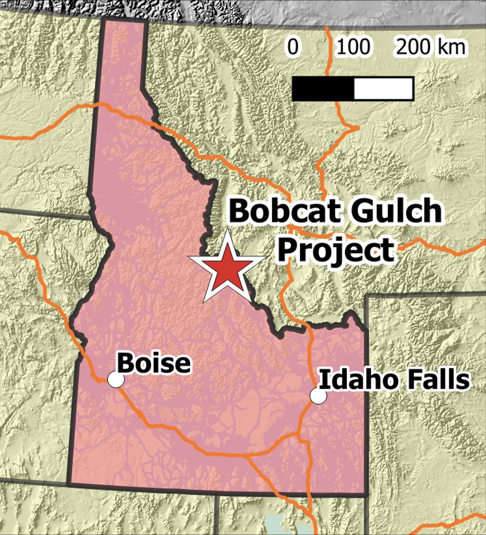
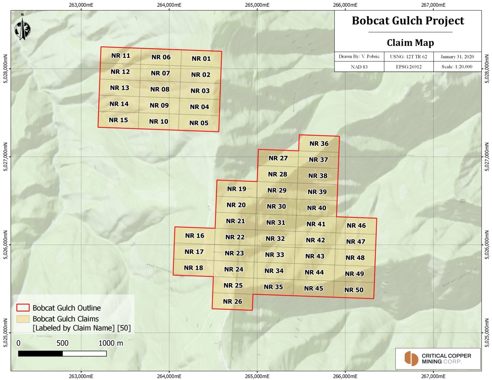
The Bobcat Gulch Project comprises 50 unpatented lode claims covering approximately 1,033 acres (418 ha) in Lemhi County, east-central Idaho. The Company’s 80% interest covers all 50 claims. Ground between the two blocks, toward Maxwell and Bobcat gulches, remains open. It lies in the Salmon River Mountains within the Salmon-Challis National Forest, about 21 km north-northwest of Salmon and 6 km south of North Fork, at elevations of roughly 1,220 to 2,150 m above the Salmon River.
Paved, year-round U.S. Highway 93 runs north from Salmon along the river past the Project, continuing to Missoula, Montana, and south to Challis. Salmon is the regional service centre and has a municipal airport. Within the claims, access is by Forest Service roads, including roads built for drilling between 1977 and 1990. The terrain is steep and rugged.
Five geological provinces meet near Bobcat Gulch. The basement is Mesoproterozoic quartzite of the Yellowjacket Formation; the Cretaceous Idaho Batholith lies to the west and the Cordilleran thrust belt a few kilometres to the east. The intrusive complex sits within the Eocene Challis volcanic field. A northeast-trending lineament along Panther, Napias, Moose and Dump creeks runs toward Bobcat Gulch, parallel to most of the dikes, and the Dump Creek fault forms the western edge of the system.
The property at a glance
Idaho Porphyry Belt
Within the northeast-trending Tertiary stock and dike network that runs from the Boise Basin to Butte, Montana, and the youngest known system in the White Clouds–Cannivan molybdenum belt.
A dated system
The U.S. Geological Survey dated biotite from a mineralized porphyry dike at 49.1 ± 0.5 Ma.
Two intrusive centres
Granodiorite centres on the east and west sides of Napoleon Ridge, more than 1.6 km apart. The western centre exposes only the top of a small stock.
Supergene chalcocite
Chalcocite enrichment beneath a leached cap hosts the best intercepts drilled to date, including 100.13 m of 0.365% Cu in BC-1.
Zoned geochemistry
BHP soil sampling outlined an inner Ag-Mo-Cu zone with an outer Mn-Pb-Zn halo, open to the southwest.
Access
Paved, year-round U.S. Highway 93 runs past the Project; Salmon, 21 km away, has a municipal airport.
Two centres, one untested flank.
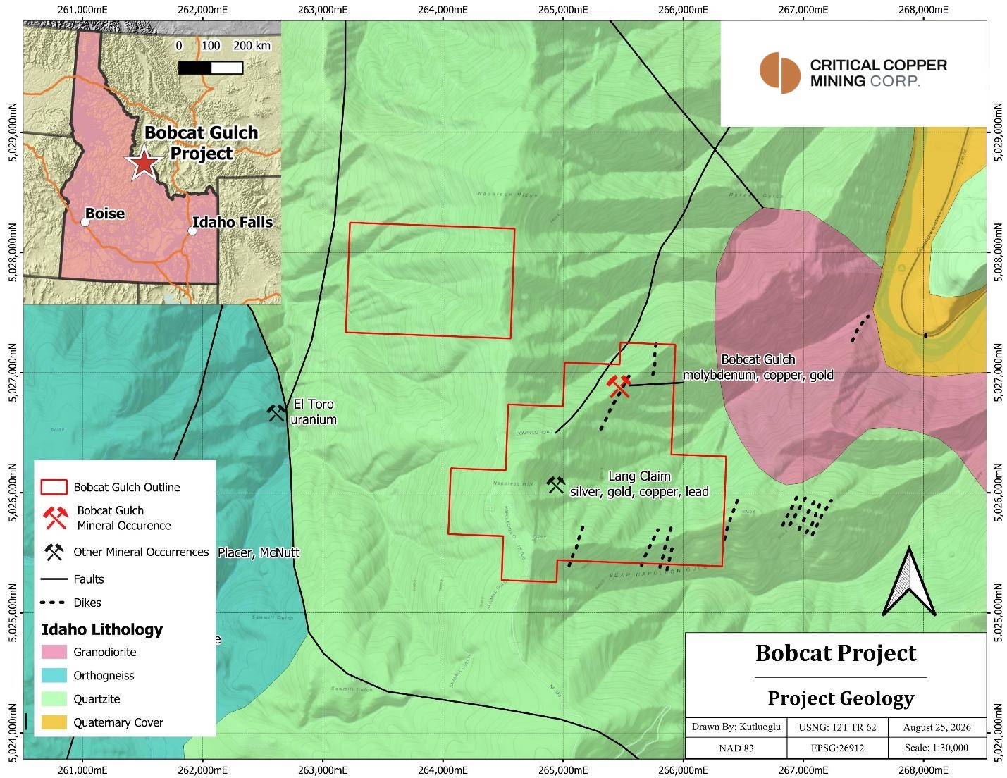
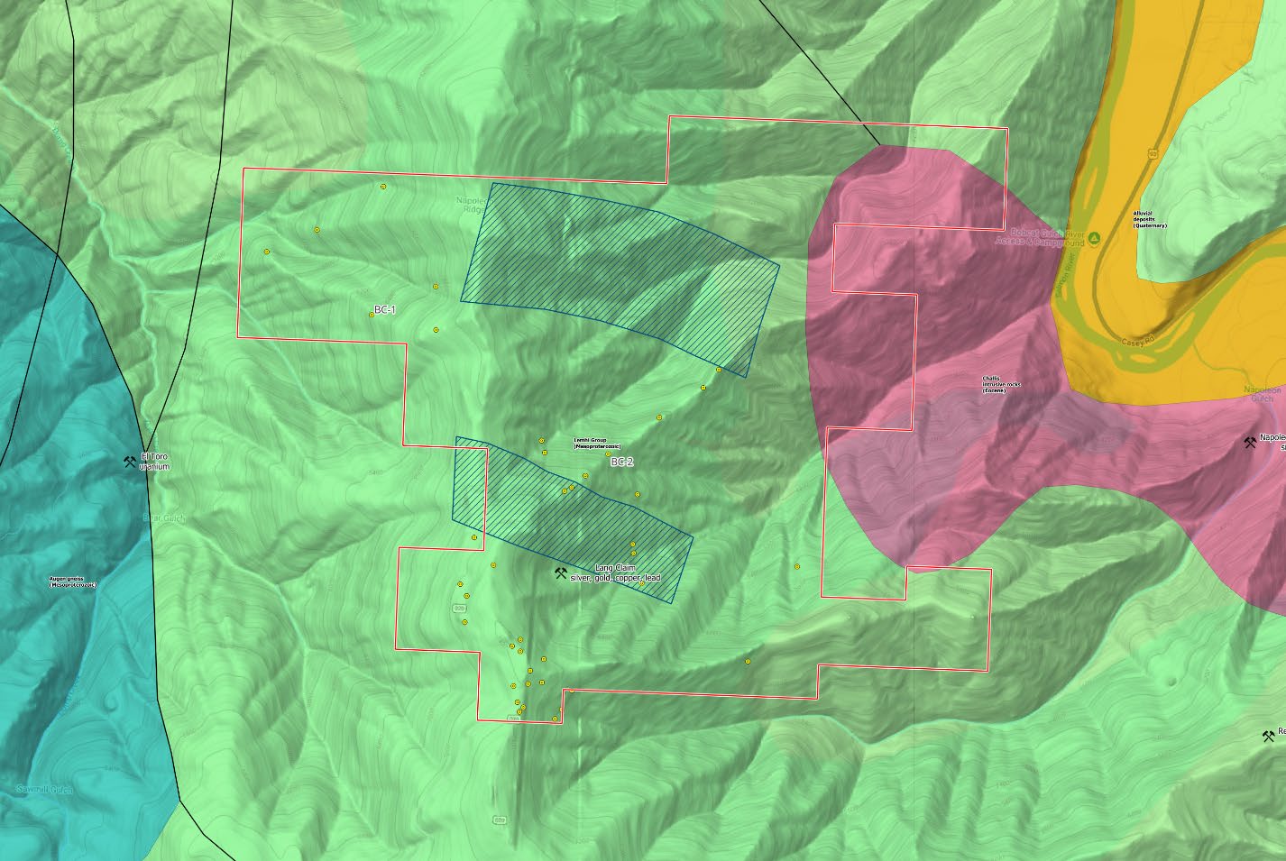
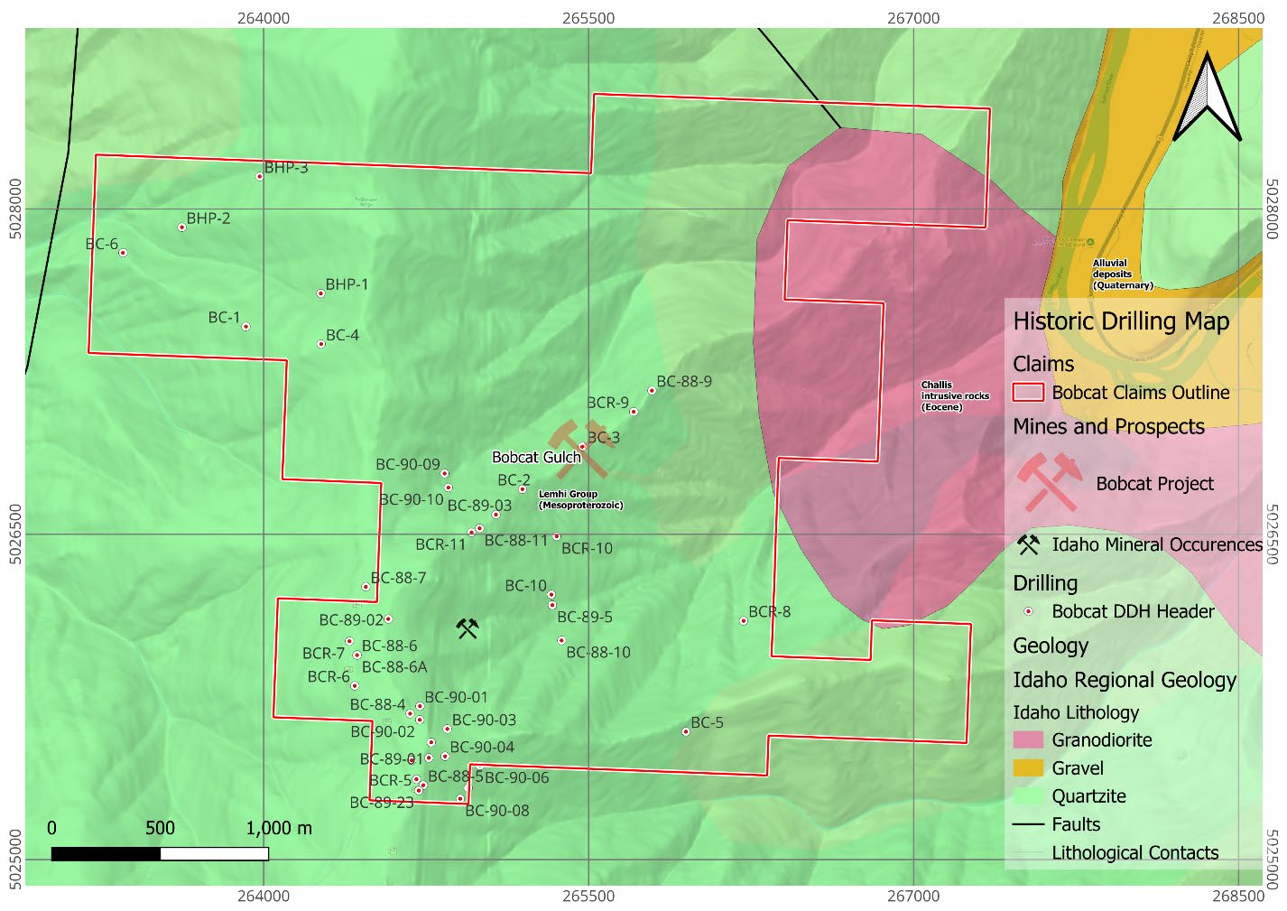
Two granodiorite centres have been identified to date, exposed on the east and west sides of Napoleon Ridge and separated by more than 1.6 km of weakly altered quartzite. The eastern centre is larger and more deeply eroded; BHP concluded that glaciation had removed its upper part. The western centre exposes only the top of a small stock, ringed by a dike swarm.
Northwest-trending normal faults bound the exposed complex and appear to have controlled its emplacement. Copper mineralization exposed on the western flank of Napoleon Ridge remains untested by drilling.
BC-1 and BC-2, the two holes that best indicate a porphyry system, lie about 1.5 km apart, both with broad copper intercepts, and roughly 2 to 2.5 km from the mapped intrusive stock. Together with the two historic IP anomalies, they outline the inferred porphyry footprint shown here.
Surface work has returned soils up to 1,860 ppm Cu and 1,018 ppb Au, and rock samples up to 6.9 g/t Au. The gold points to epithermal veins within the broader porphyry system. This may reflect a level high in the system, or a later pulse overprinting an earlier one, which would indicate multiple mineralizing pulses.
- Intrusive sequence: quartz diorite porphyry, then granodiorite, then quartz latite porphyry. The quartz latite porphyry is the most consistently altered and mineralized phase.
- Age: 49.1 ± 0.5 Ma on biotite from a mineralized porphyry dike; 48.5 ± 0.7 Ma on a later mafic dike (U.S. Geological Survey).
- Alteration: quartzite next to the intrusions is bleached, silicified and altered to sericite and clay, with quartz stockwork and 1–5% pyrite; further out it carries secondary biotite. The intrusive rocks are propylitically altered.
- Geochemistry: an inner Ag-Mo-Cu soil anomaly ringed by a Mn-Pb-Zn halo, open to the southwest (BHP, 1995).
Three styles of copper-molybdenum.
The Property hosts three styles of copper-molybdenum mineralization associated with the Eocene intrusive complex.
Separately, gold-bearing quartz veins in the Yellowjacket Formation, including the historical Lang and Sims workings, were the focus of drilling from 1988 to 1992. The Lang Mine was developed in the 1930s on the east side of Napoleon Ridge, with reported production of approximately 5,000 oz of gold. BHP found that the gold does not correlate with the porphyry.
- Supergene chalcocite enrichment in altered quartzite and quartz latite porphyry beneath a leached cap. It is exposed on the margins of both intrusive centres and hosts the best intercepts drilled to date (BC-1, BC-2, BC-5).
- Primary chalcopyrite in veinlets, fractures and disseminations in several intrusive phases, with 1–5% pyrite.
- Molybdenite in quartz veinlets and silicic dikes, mainly on the east side. Its weak correlation with copper suggests a separate molybdenum event.
Nine core holes into the porphyry.
41 historic holes lie within the claims, drilled between 1977 and 1994 by five operators; the recompiled database holds 104 collar locations in the wider area. Most were shallow reverse-circulation holes targeting gold, many poorly documented; only nine core holes tested the porphyry.
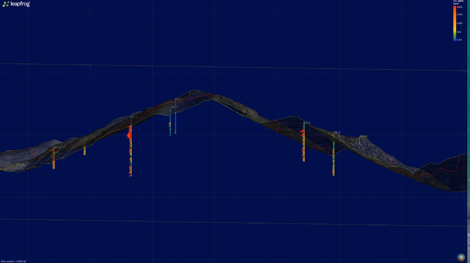
The most significant historical drilling to date is Cominco’s: six vertical core holes, BC-1 to BC-6, drilled after geological mapping, rock and soil geochemistry and three induced-polarisation surveys. Copper assays for all six holes are in the project database. BC-1, on the west side of Napoleon Ridge, returned 100.13 m of 0.365% Cu from 74.83 m in chalcocite-enriched quartzite, including 51.05 m of 0.486% Cu. BC-2 returned 44.20 m of 0.270% Cu from 60.35 m, and a deeper 92.05 m of 0.124% Cu. BC-5 returned 2.44 m (8 ft) of 1.02% Cu in chalcocite-enriched quartzite. BC-3 cut alteration similar to the upper part of BC-2, with less chalcopyrite, and was stopped for mechanical reasons.
Historical
| Hole | From (m) | To (m) | Interval (m) | Cu (%) | Comment |
|---|---|---|---|---|---|
| BC-1 | 74.83 | 174.96 | 100.13 | 0.365 | Chalcocite-enriched quartzite |
| incl. | 118.57 | 169.62 | 51.05 | 0.486 | |
| and | 134.11 | 166.12 | 32.01 | 0.571 | |
| BC-2 | 60.35 | 106.07 | 44.20 | 0.270 | Chalcocite-enriched quartzite |
| incl. | 71.63 | 76.35 | 4.72 | 0.657 | |
| BC-2 | 214.27 | 306.32 | 92.05 | 0.124 | |
| and | 214.27 | 222.50 | 8.23 | 0.204 | |
| BC-5 | 86.87 | 89.31 | 2.44 | 1.02 | Chalcocite-enriched quartzite |
| Hole | Year | EOH (m) | Location |
|---|---|---|---|
| BC-1 | 1977 | 477.3 | West side of Napoleon Ridge |
| BC-2 | 1977 | 313.3 | East centre, Bobcat Gulch |
| BC-3 | 1978 | 353.6 | East centre; stopped for mechanical reasons |
| BC-4 | 1980 | 279.2 | Top of Napoleon Ridge |
| BC-5 | 1980 | 270.7 | Southeast |
| BC-6 | 1982 | 174.4 | Western stock |
The historic drill results disclosed above are derived from historical documentation prepared by prior operators. The Qualified Person has not independently verified the sampling, analytical or security procedures used, and the Company has not been able to review the original assay certificates or verify the drill hole collar locations, downhole surveys or core recovery. Reported intervals represent drilled core lengths; true widths are not known. The Company considers the historic drill results to be relevant in guiding future exploration but cautions that they should not be relied upon.
Copper down the historic holes.
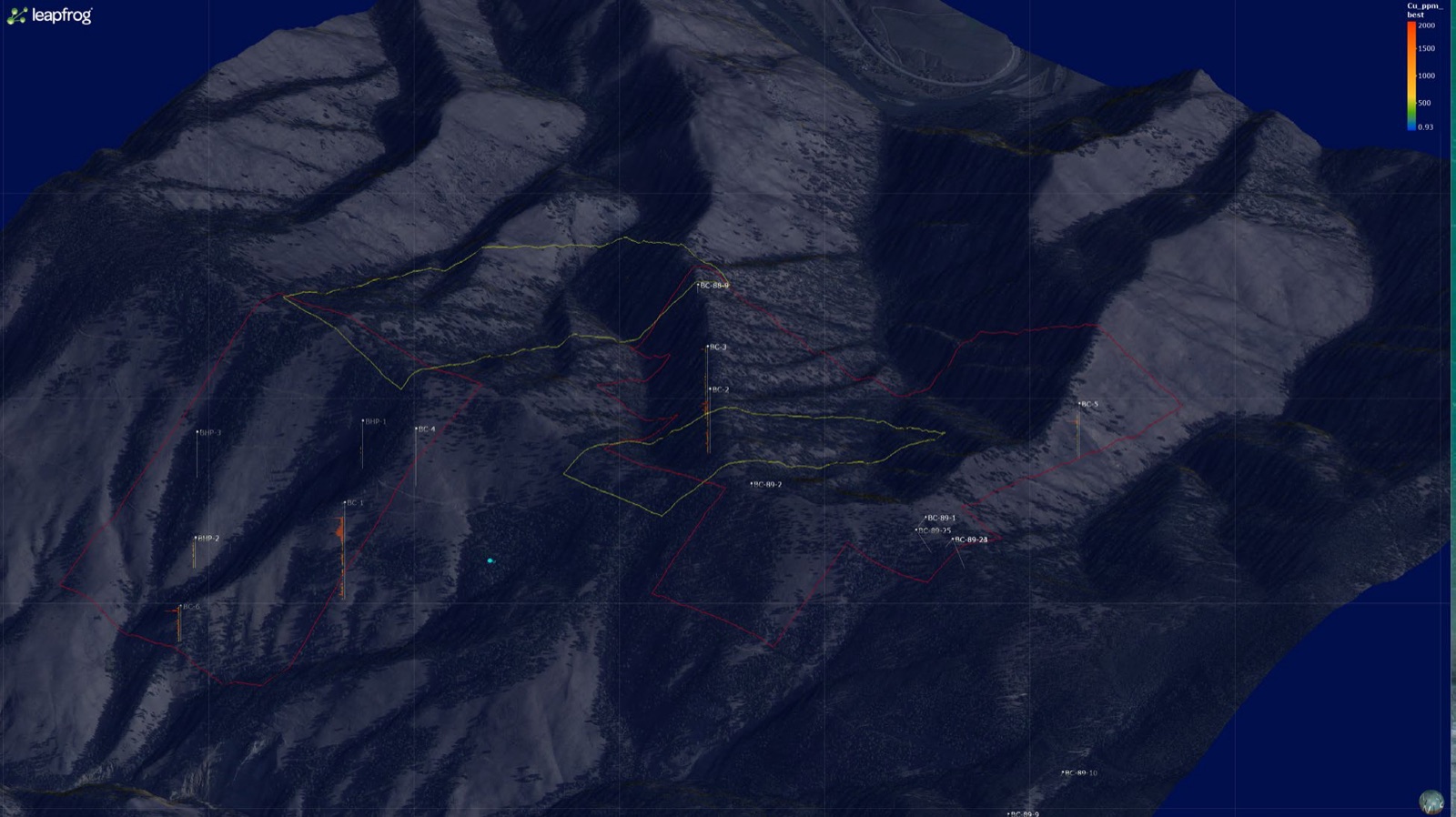
Historic drill holes in the Company’s 3D model, coloured by copper grade (ppm), with BC-1 and BC-2 standing out as the most strongly mineralized.
Five operators, four decades.
Work on the Property runs from Cominco’s first core holes in 1977 through gold-focused drilling in the late 1980s and early 1990s, BHP’s 1995 soil survey and the 2019 surface sampling that confirmed porphyry-style alteration and copper mineralization.
Sources: Cominco progress reports (Bunning, 1978, 1980); Bunning and Burnet (1981); Corona Gold (1989); Formation Capital (1992); BHP Minerals (1995); USGS Open-File Report 98-478 (1998); Idaho Geological Survey Geologic Map 52 (2016).
- 1977–1982Cominco American maps the system, completes rock and soil geochemistry and three induced-polarisation surveys, and drills six vertical core holes, BC-1 to BC-6: first in a joint venture with Bear Creek Mining, and on its own account from 1978.
- 1988–1992Corona Gold and Formation Capital drill gold-bearing quartz veins elsewhere on the claim block, including the historical Lang and Sims workings, mostly with shallow reverse-circulation holes.
- 1995BHP Minerals soil sampling outlines an inner Ag-Mo-Cu zone and an outer Mn-Pb-Zn halo, open to the southwest.
- 1998The U.S. Geological Survey dates a mineralized porphyry dike at 49.1 ± 0.5 Ma.
- 2016Idaho Geological Survey mapping includes the Bobcat Gulch stock in its Eocene dacite–rhyolite intrusive unit.
- 2019Surface sampling confirms widespread porphyry-style alteration and copper mineralization.
- 2026Historic data recompiled into a 104-collar database.
- Aug 2026Agreement to acquire an 80% interest from BG Copper Corp.
- ClosedThe Company completes the acquisition of its 80% interest, issuing 20,000,000 units to BG Copper Corp.
80% interest, acquired.
The Company has completed the purchase of an 80% interest in the mineral claims that make up the Bobcat Project from BG Copper Corp., an arm’s length party, under a mineral claims purchase agreement. The 80% interest covers all 50 claims.
On closing, the Company issued BG Copper Corp. 20,000,000 units, each of one common share and one warrant.
Acquisition closed
News releases by email. Nothing else.
Receive the latest news releases and corporate updates from Critical Copper Mining Corp. directly to your inbox.